Final days of Doggerland interactive map and animation
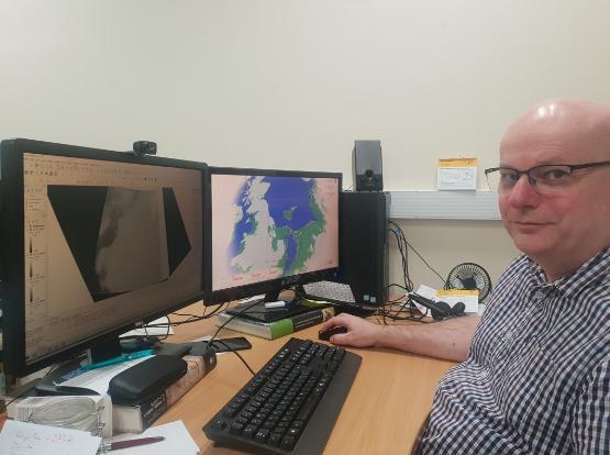
Archaeologists from the University of Bradford have created an interactive simulation tool to chart the evolution (and demise) of Doggerland – the Ice Age landmass that once connected the UK to mainland Europe.
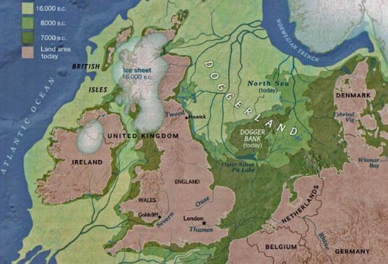
It is part of a project known as Unpath’d Waters, funded by the Arts and Humanities Research Council, which has involved scientists from the university mapping the entirety of the sunken land bridge.
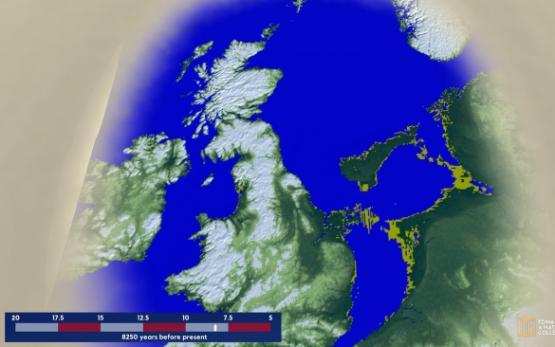
The simulation has been released together with an animation – available on YouTube – showing how Doggerland changed from 20,000 years ago, the height of the last glacial maximum, to just 5,000 years ago, by which time it was inundated by the North Sea to form what is now called the Dogger Bank.
The animation and simulation show Doggerland as a country stretching across the North Sea, then shrinking to an archipelago, then a single island, before finally being swallowed by the waves, which was precipitated by an event known as the Storegga tsunami, which followed an underwater landslide roughly the size of Scotland that occurred off the coast of Norway about 8,000 years ago.
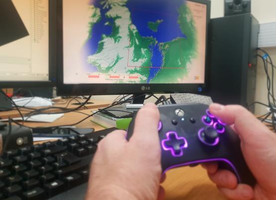
Dr Phil Murgatroyd, who created the animation and interactive map, said: “This interactive map is available to anyone to download and use, it shows the area of the North Sea that once comprised Doggerland – a land bridge between the UK and Europe, which is now beneath the waves. The map allows people to see what the landscape looked like from 5,000 years ago all the way back to 20,000 years ago.
“The landscape is constantly transforming. It used to be above the sea, now it’s below the sea. This simulation provides a tool to see how that unfolded.”
The software is free to download and use. It can be set up in a public exhibition and easily controlled by an X-box compatible game controller but can also be used on a standard Windows desktop PC.
This simulation forms the base of a more complex and interactive version for home use, in which simulated humans live within the small-scale environment and can be influenced by the user. This version is under development and will be continuously improved as part of the University’s involvement in the ERC-funded Subnordica project.
The hunt for human civilisation
Artificial intelligence will guide marine archaeologists to ‘Goldilocks zone’ of lost civilisations.
Marine archaeologists from the University of Bradford, working on projects funded by the Arts and Humanities Research Council and the European Research Council, will use artificial intelligence to help pinpoint evidence of prehistoric human settlements on the bed of the North Sea.
They have already mapped 188,000 square kilometres - an area about the size of England and Scotland combined - of seabed and now they plan to use AI to narrow down the search for signs of prehistoric human settlements in Doggerland. Once above the sea, they were gradually inundated by successive sea-level rises, disappearing beneath the waves about 8,000 years ago.
Scientists are already working with energy companies to better understand underwater topography.
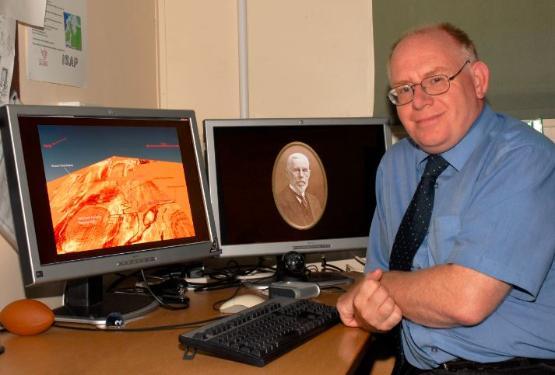
Professor Vince Gaffney, who leads Bradford’s Submerged Landscapes Research Centre, said future archaeological surveys could also help us gain a better understanding of modern-day climate change.
He said: “So far, the only evidence we have that people once actually lived on what is now the bottom of the North Sea - and other oceanic areas - have been chance finds dragged up by accident by trawlers or through dredging.
“But do we know people once lived on what is now the seabed? It’s a certainty, it’s just a case of identifying what we call the ‘Goldilocks zone’, which combines three variables: whether people lived there, whether evidence of that has been preserved, and whether it is still accessible today.
“We are now in a position where we have mapped a large section of seabed and we can use artificial intelligence to assist us in predicting where humans may have once lived and the evidence survives.”
In 1931, a trawler named Colinda dragged up a harpoon 60 miles off the Yorkshire coast – known as the ‘Colinda Harpoon’, it is thought to be late Palaeolithic and was preserved in a block of peat. More recently, archaeologists announced the discovery of an 11,000-year-old stone wall (originally built on dry land) in the Bay of Mecklenburg in the Baltic Sea. This is the latest in a series of underwater finds that point to a time when humans inhabited vast areas of the Continental shelf, much of which is now under water.
Prof Gaffney went on “The only lands on Earth that have not been explored in any depth by science are those that have been lost to the oceans. Global warming at the end of the last Ice Age led to the inundation of vast landscapes that had once been home to thousands of people.
“These lost lands hold a unique and largely unexplored record of settlement and colonisation linked to climate change over millennia. Amongst the most significant is Doggerland. Occupying much of the North Sea basin between continental Europe and Britain it would have been a heartland of human occupation and central to the process of re-settlement and colonisation of northwestern Europe during the Mesolithic and the Neolithic.”
However, because much of that land has already been earmarked by the Government for offshore wind development, including the World’s largest wind farm, archaeologists are keen to work with developers to ensure archaeological concerns are heard.